


Browse Places
- Belper
- Bewdley
- Birmingham
- Bridgnorth
- Coalbrookdale
- Coventry
- Cromford
- Derby
- Derbyshire
- Dudley
- Gloucester
- Handsworth
- Hereford
- Ironbridge
- Kidderminster
- Lichfield
- Ludlow
- River Severn
- Shrewsbury
- Shropshire
- Smethwick
- Stafford
- Staffordshire
- Stoke-on-Trent
- Stourbridge
- Stourport
- Tenbury
- Tewkesbury
- The Wrekin
- Tipton
- Walsall
- Warwick
- Warwickshire
- West Bromwich
- Wolverhampton
- Worcester
- Worcestershire
Warwickshire
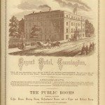
Advert for Regent Hotel, Leamington
The New Illustrated Directory Entitled Men and Things of Modern England, 1858
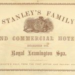
Advert for Stanley’s Family and Commercial Hotel
The New Illustrated Directory Entitled Men and Things of Modern England, 1858
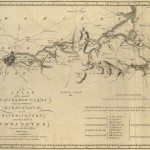
Canal Maps
Image: ‘PLAN of the intended NAVIGABLE CANAL from the TOWN of BIRMINGHAM into the RIVER SEVERN near the… read more »
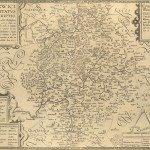
Early Warwickshire Maps
Image: The ‘Anonymous’ map of Warwickshire Printed by John Overton of London. The date on it is… read more »
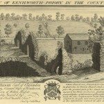
East View of Kenilworth Priory in Warwickshire
Source: Samuel & Nathaniel Buck, Views of Ruins of Castles & Abbeys in England, Part 2, 1726-1739 (nd),… read more »
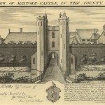
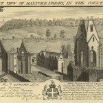
East View of Maxtoke Castle in Warwickshire
Source: Samuel & Nathaniel Buck, Views of Ruins of Castles & Abbeys in England, Part 2, 1726-1739 (nd),… read more »
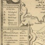
Keys and Explanations
Image: One of the earliest keys, from the late seventeenth century copy of the 1603 ‘Anonymous’ map. This… read more »
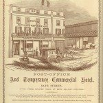
Leamington Spa Post-Office and Temperance Commercial Hotel
Image from: The New Illustrated Directory Entitled Men and Things of Modern England, 1858
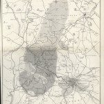
Map of the Mining and Manufacturing District of South Staffordshire, Warwickshire, etc.
William Hawkes Smith, Birmingham and its Vicinity as a Manufacturing and Commercial District (London and Birmingham, 1836).… read more »
North West View of Maxtoke Priory in Warwickshire
Source: Samuel & Nathaniel Buck, Views of Ruins of Castles & Abbeys in England, Part 2, 1726-1739 (nd),… read more »

Samuel and Nathaniel Buck’s Views of Ruins of Castles & Abbeys in the Midlands 1726-1739
Image: South East View of Goodrich Castle in the County of Hereford Source: Samuel & Nathaniel Buck, Views of… read more »
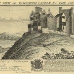
South East View of Tamworth Castle in Warwickshire
Source: Samuel & Nathaniel Buck, Views of Ruins of Castles & Abbeys in England, Part 2, 1726-1739 (nd),… read more »